

Early Byzantine churches of Syria
On the photo: 10 century frescoes in the Mar Musa monastery
On the project
The project of IHMC RAS on 3D documentation of early Byzantine churches in Syria was launched in early 2021 with the help of a grant from the Russian Foundation for Fundamental Research and the Imperial Palestinian Orthodox Society. The main objective of the project is the documentation of the key sites of Byzantine architecture in this part of the Middle East. The project clearly inherits the scientific tradition of architectural documentation of the 18th and 19th centuries. It was then that the foundations of modern conceptions about the region’s history were laid by travelers who visited these lands. In many ways, the fundamental publications of Vogue and Butler still remain the desktop reference books of the researcher of Middle Eastern architecture. The architectural documentation of key sites to the history of early Christianity, carried out at a modern methodological level, allowed to fix the current state of these most important objects, to create a database of current knowledge about their history, and became a new research tool for scientists and restorers.
General information
19 Early Byzantine churches (of the V-VI centuries) and their immediate architectural context were documented in 9 historical centers of Syria from Aleppo in the north to Southern Hauran in the south and from the Orontes valley in the west to the Syrian desert in the east.
3D models of churches and their context were created by photogrammetry. Scientific photodocumentation of objects was carried out, dimensional drawings of plans, facades and cross-sections were drawn, historiographic reviews were written, bibliography was collected and modern scientific descriptions of monuments were made.
The threats to which the ancient architecture of Syria was exposed are still relevant, and the access of monuments to researchers is still extremely limited. This project seems to be a good starting point for creating a repository of 3D models of endangered architectural and archeological sites that are inaccessible to researchers.
Al-Halawiyah Madrasa
Byzantine basilica of Justinian period
Qasr ibn Wardan
A military and administrative complex of the 6th century
Deir es-Salib
Monastic complexes of late 6th – early 7th centuries
Bosra
The capital of Roman Arabia and center of a metropolis
Ezra
Ancient Zora and two churches of the 6th century
Shakra
Central plan martyrium, basilica and a tower mausoleum
Burqush
An unusual basilica at the frontier with Lebanon
Apamea
The capital of the Seleuсids and the center of the Church of the East
Palmyra
The “Bride of the desert” and its christian sector
Methodology
Digital photogrammetry (SfM, Structure from Motion), widely used in archeology and cultural heritage protection in recent decades, was chosen as the basic method of documenting monuments and their surroundings. Such complex objects require a structural approach in the organization of survey. We used three levels of documentation. 1) a general survey of the entire territory around the surveyed object, allowing to visualize and analyze the geographical and topographical context of the monument; 2) documentation of the architectural object itself, allowing to get detailed data on the features of masonry, performed reconstructions and damages the object suffered; 3) documentation of architectural details, allowing to record in detail the elements of ornamentation, structural elements and damage caused by the destruction of details
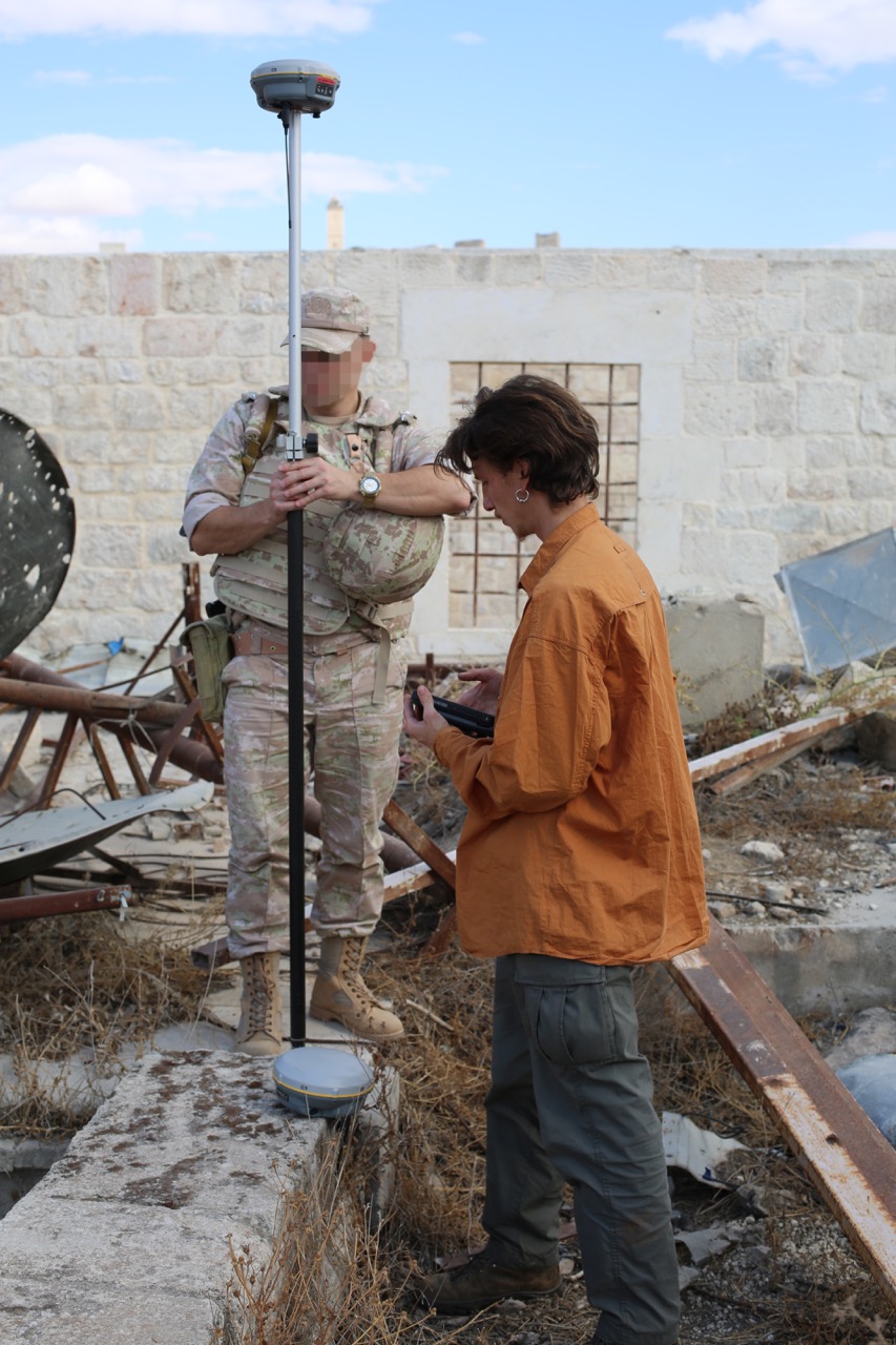
Before the start of the survey, a network of benchmarks obtained by the methods of differential GNSS-observations was created on each site, from which the survey network was further developed with the help of the Leica TS07 5″ total station. The resulting geographic coordinates were converted to the metric system – WGS 84 UTM 37N (in one case, on the border of Syria and Lebanon, the basilica in Burkush – was located in the UTM 36N zone). The use of the world coordinate system, independent of national geodetic standards, seems to us to be very important when working on sites explored by international teams of researchers, and will help preserve continuity between data in the future.
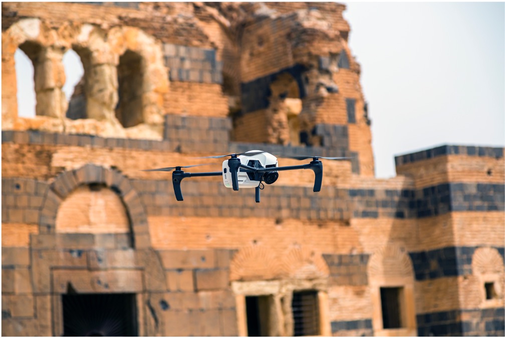
For general documentation, we used an industrial-level UAV, which allows us to cover wide areas without loss of detail. Geoscan Gemini with Sony UMC-R10C camera and DJI Matrice 300 with DJI Zenmuse H20T or DJI Zenmuse L1 cameras. Geodetic documentation was carried out by RTK methods, by receiving corrections from a base station installed on a previously prepared known point. A network of control points placed on the ground was used to control the accuracy of positioning and the quality of the final data. At this level, the survey was conducted in order to cover the widest possible context. Ground photographs were not used to capture the first level, and the reconstruction of the vertical elements of the architecture was performed only on the basis of aerial photographs taken at an angle of 45 degrees.
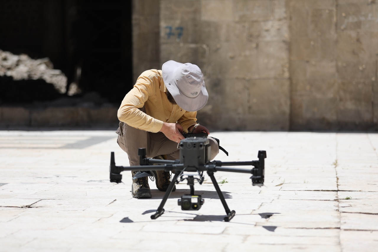
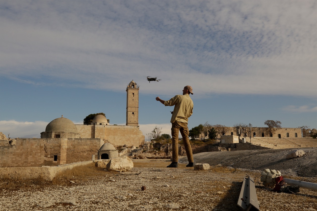
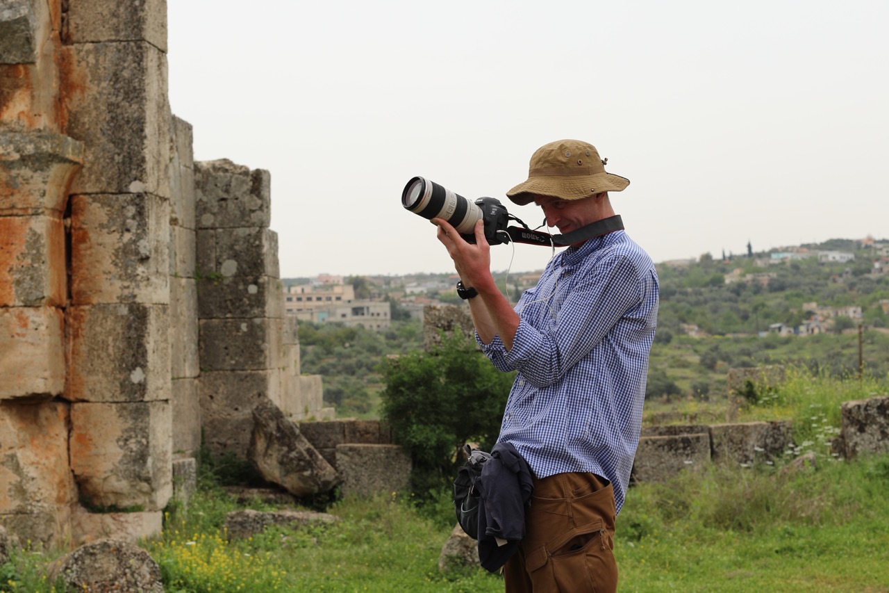
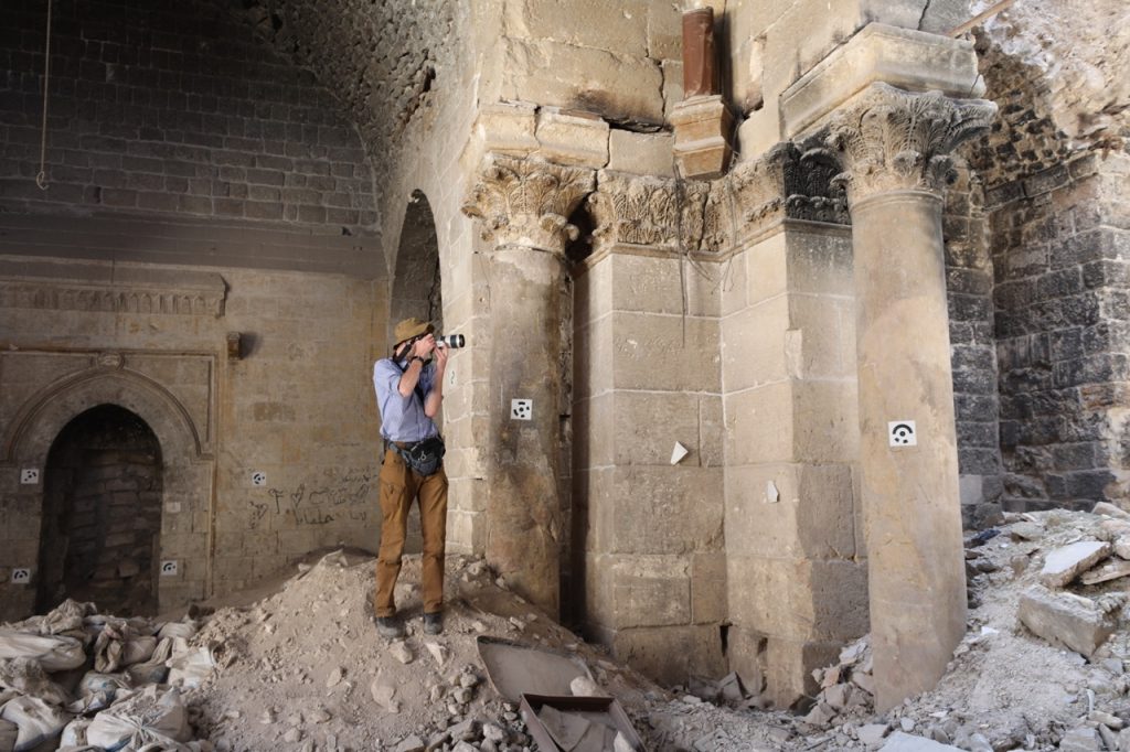
In the documentation of the second level — that is, directly of the architectural monument — a combination of aerial photography with a DJI Mavic 2 Pro drone (in some cases DJI Mavic 3) and ground photos with a Canon 5D Mark III full-frame camera with EF 17-40, EF 16-35 and EF 24 L2 lenses was used. Georeferencing was carried out through coordinated control points located on the perimeter of the documented objects.
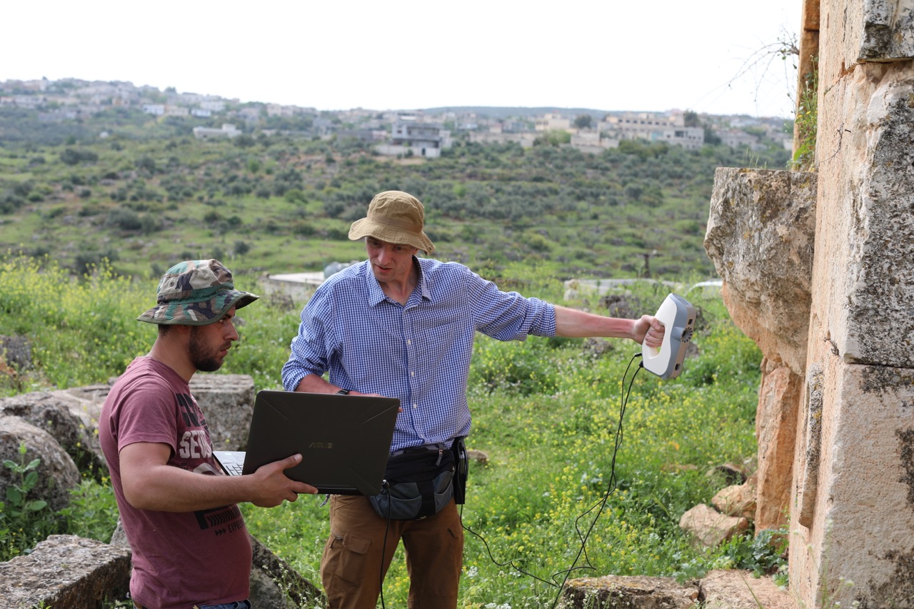
The same Canon 5D Mark III camera with lenses EF 24 L2 or EF 50 1:1/4 was used when documenting at the third level – architectural details of the monuments in lapidaries or in situ. In some cases Artec Eva 3D structured light scanner was used. Scaling of the models in this case was carried out with the help of a pocket scale with a color palette and an architectural folding ruler.
Manager and members of the grant:
Soloveva Natalya Fedorovna, deputy director of IHMC RAS, director of RAC IHMC RAS (grant manager)
Jegor Blochin, IHMC RAS
Andrey Vinogradov, Higher School of Economics
Denis Jolshin, State Hermitage Museum
Eduard Kazakov, independent researcher
Evgeniy Radchenko, Geoscan GC
Photos: J. Blochin, Yu. Rumyantsev, A. Gorodilov, A. Vinogradov:
Photogrammetry documentation: J. Blochin, Yu. Rumyantsev
Geodesy: M. Gorodilov
Post processing: Yu. Rumyantsev, J. Blochin, N. Silaeva, Geoscan GC
DB Developement: E. Kazakov:
Drawings: M. Tushkina and the team of the Department of Architectural Restoration of the RAC IHMC RAS
Texts: A. Vinogradov, D. Jolshin, J. Blochin