
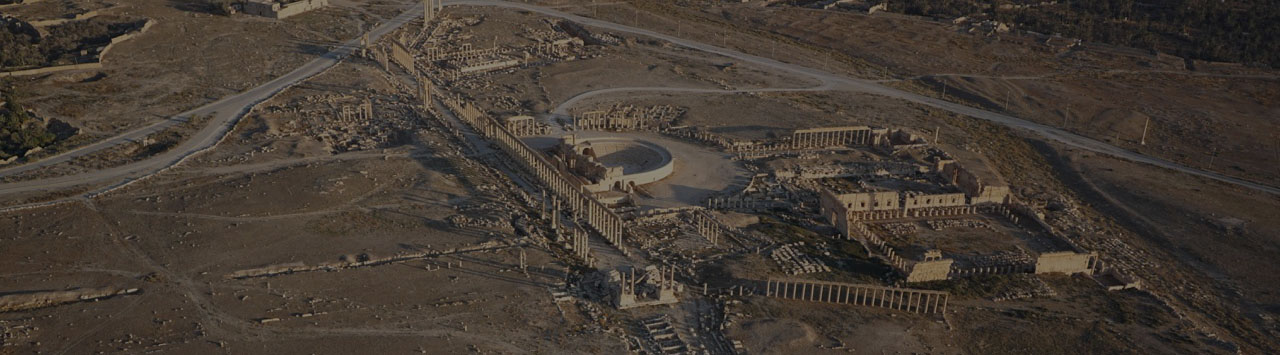
View of central part of Palmyra
Palmyra 3D
About the Project
The Palmyra 3D project was conceived and implemented by researchers from the Institute for the History of Material Culture of the Russian Academy of Sciences (IHMC RAS) since 2016, with the support of the Geoscan group of companies, specialists from the State Hermitage Museum, and the architectural workshop of Maxim Atayants. The project’s goal was the complete documentation of the current state of the UNESCO World Heritage Site “Archaeological Monuments of Palmyra,” the creation of a three-dimensional model of its post-war condition, and a comprehensive assessment of restoration prospects in collaboration with Syrian specialists.
General Information
The interactive 3D model of Palmyra is available here or at: https://palmyra-3d.online/
The active phase of fieldwork for the 3D survey of Palmyra took place from 2016 to 2020. During this period, two expeditions were conducted to collect data and monitor the ancient city’s condition:
- Over 55,000 photographs of the ancient city were taken.
- The survey covered an area of more than 20 square kilometers.
- The survey was conducted using UAVs (both fixed-wing and multirotor types), as well as professional ground-based photo equipment.
- Models of the entire ancient city were created, consisting of 700 million points.
- Terrain models (resolution up to 7 cm/pixel) and orthophotoplans (resolution up to 3 cm/pixel) were developed.
3D model
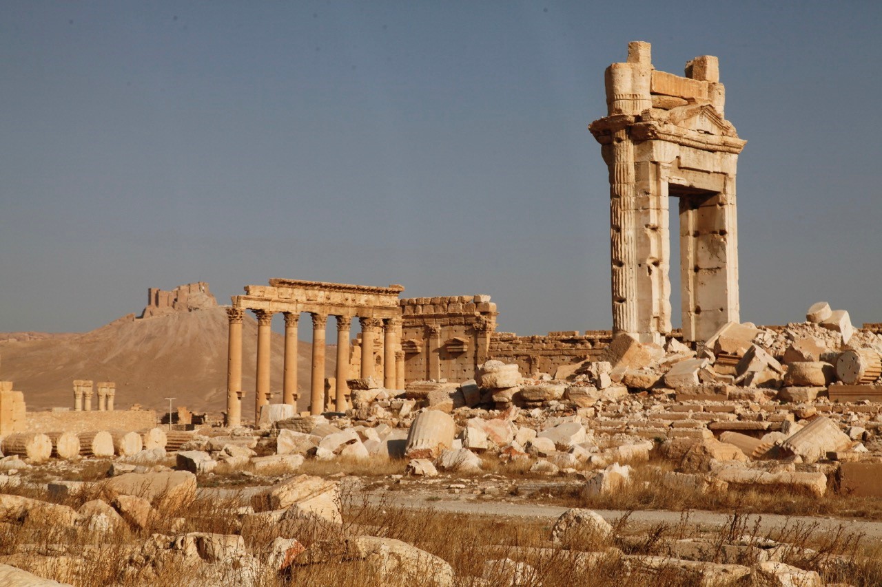
Since 2016, the IHMC RAS research team has been working on creating a comprehensive digital three-dimensional system, Palmyra 3D, following the vandalistic attack and destruction of the monument by ISIS terrorists (banned in the Russian Federation). Facing the threat of Palmyra’s complete destruction, IHMC RAS specialists were among the first in the world to emphasize the need to save the monument and preserve data for future generations. Over several years, an enormous amount of work was completed: the total survey area was 20 square kilometers, and more than 55,000 high-resolution aerial photographs were taken. The model elements consist of nearly 700 million points. The aerial survey was complemented by several thousand ground-based photographs of the most significant ancient city objects, particularly those severely damaged by terrorists (the Great Colonnade, the Monumental Arch, the Temples of Bel and Baalshamin, the Theatre).
Russian scientists obtained highly accurate three-dimensional models of the terrain and architectural objects, creating detailed orthophotoplans with spatial resolution significantly higher than existing satellite images. This allows archaeologists and cultural heritage management specialists to study the plan of Palmyra in detail with a resolution of up to 3 cm.
“We are glad that such a great and large-scale project to digitize Palmyra that took us several years finally has been completed. The ancient city of Palmyra is among the most valuable world heritage sites and its protection is beneficial for all humanity. Over the past four years, the 3D-model of Palmyra was adjusted and updated several times as the site was occasionally attacked by the terrorists. Despite all the risks and potential threats, we have finalized the 3D-model of Palmyra and are happy to share it with Syria and with the world” said project leader, Director of the Rescue Archaeology Center, and Deputy Director of IHMC RAS Natalia Solovyova.
The work of IHMC RAS scientists resulted in the creation of a unique document – the most detailed and up-to-date documentation of the state of the world-famous monument, allowing for the discussion of Palmyra’s restoration based on accurate data.
Based on the created 3D model, IHMC RAS scientists continuously update and expand the Geographic Information System (GIS) PalmyraGIS, whose database includes the results of all previous archaeological and historical research of the city, as well as geospatial representations of the monument’s current state. Each object is assigned a description of the time, degree, and nature of the damage it has sustained over the past years.
The created 3D model and the evolving PalmyraGIS are not only documents recording the barbaric destruction of humanity’s cultural values but also research tools that surpass all previously used methods for studying this ancient monument in their universality.
The obtained data provide a reliable basis for planning any further heritage management activities in Palmyra – allowing for planning restoration work, conservation, tourism, and further scientific research of the ancient city – a UNESCO World Heritage Site.
History of the Palmyra 3D Project
In September 2016 and September 2019, expeditions from the Institute for the History of Material Culture of the Russian Academy of Sciences (IHMC RAS), led by Deputy Director Natalia Solovyova, conducted unprecedented work in Palmyra. The goal was to create a three-dimensional digital model of the monument’s current state and document the damage it had received due to actions by ISIS terrorists (banned in Russia).
In 2016, the IHMC RAS expedition included military topographers and a State Hermitage employee. The equipment was provided by the Geoscan group of companies.
The 2019 IHMC RAS expedition included architects from Maxim Atayants’ Architectural Workshop, who worked on the photo documentation of the architectural remains of the Temple of Bel to refine their created three-dimensional model of the temple. Specialists from the “Unmanned Systems” group conducted the survey.
Results of the Expeditions
- Highly accurate three-dimensional models of the terrain and architectural objects.
- Detailed orthophotoplans with spatial resolution significantly higher than existing satellite images.
- Most detailed and up-to-date recording of the current state of the world-famous monument.
- Without visiting the monument, restoration specialists and architects could begin evaluating and planning restoration work using the detailed aerial photography.
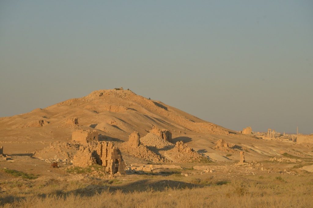
- Documented significant cultural destruction by ISIS, affecting the Temples of Bel and Baalshamin, the Triumphal Arch, the Zenobia Column, the Necropolises and Funerary Towers, Diocletian’s Camp, the Fakhr-al-Din Castle, and the Archaeological Museum of Tadmur. The theater’s proscenium was destroyed, and the tetrapylon was blown up. Numerous looter pits and trenches were discovered on the site. Other architectural objects remained intact or sustained minor damage.
All the post-processing was made jointly by IHMC RAS and Geoscan GC


Further Use of the 3D Model
Based on the created three-dimensional model of the UNESCO World Heritage Site “Archaeological Monuments of Palmyra,” IHMC RAS is developing a PalmyraGIS, which includes:
- Detailed raster orthophotoplan of the area.
- Digital terrain model.
- Detailed vector plan of all objects included in the “Archaeological Monuments of Palmyra.”
- Photo documentation linked to objects.
The database encompasses the results of all previous archaeological and historical research of the city, information about individual archaeological and architectural objects – their characteristics, dating, research status, and the geospatial representation of the monument’s current state – a description of the time, degree, and nature of the damage it has sustained over recent years.
This work is entirely unique, for the first time compiling diverse information about three centuries of studying the ancient city and its current state into one software framework.
Project Team
- Natalia Solovyova – Project Leader, Director of the Rescue Archaeology Center, Deputy Director of IHMC RAS.
- Yegor Blokhin – Specialist in Digital Archaeology, Research Fellow at IHMC RAS.
- Sergey Solovyov – Specialist in Classical Archaeology, Research Fellow at IHMC RAS and the State Hermitage Museum.